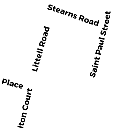
20 STEARNS RD 65
Owner Information
DING LI
20 STEARNS RD #65
BROOKLINE, MA 02446


Property Details
20 STEARNS RD 65 is classified as a Residential Condominium (Mid-rise).
The primary structure on this property was built in 1967. There is 953ft2 of residential/living space within this property. This property is listed as having 4 rooms.
20 STEARNS RD 65 is valued at $757,000. The land is valued at $0 and the structures are valued at $757,000.
The most recent deed for 20 STEARNS RD 65 is recorded at the local registrar in Book 31869, Page 447. 20 STEARNS RD 65 was last sold on Friday, November 1, 2013 for $600,000.
Assessment data from fiscal year 2021.
Flood Data
According to the FEMA National Flood Hazard Layer, this property does not appear to be in a flood zone. It may also be in an area not yet reviewed. Nonetheless, confirm this information prior to taking any action.
To view the flood hazards around this property, create a FEMA "Firmette" Map of the area around 20 STEARNS RD 65.
Broadband Internet Providers
| Provider | Type | Bandwidth (mbps) | |
|---|---|---|---|
| VSAT Systems, LLC. | Satellite | 2 | 1 |
| Comcast | Cable | 1000 | 35 |
| RCN | Cable | 25 | 4 |
| RCN | Cable | 500 | 20 |
| RCN | Cable | 1000 | 20 |
| Starry, Inc. | Fixed Wireless | 200 | 200 |
| netBlazr Inc | Fixed Wireless | 50 | 50 |
| GCI Communication Corp. | Satellite | 0 | 0 |
| HughesNet | Satellite | 25 | 3 |
| Crown Castle Fiber | Fiber | 0 | 0 |
| Viasat Inc | Satellite | 100 | 3 |
| Verizon New England Inc. | DSL | 15 | 1 |
Broadband service provider data from December 2020.
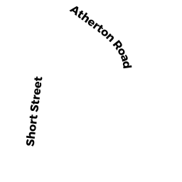
Adjacent Properties
- 12 14 STEARNS RD
Apartments with Four to Eight Units owned by MARJORAM LLC - 30 STEARNS RD 103 & G-X
Residential Condominium owned by VEKSLER MARK - 30 STEARNS RD 504
Residential Condominium owned by ARONSON HELENE SARI - 30 STEARNS RD 101 & PZ
Residential Condominium owned by VEKSLER MARK - 30 STEARNS RD 104
Residential Condominium owned by ZHANG WEN - 30 STEARNS RD 201
Residential Condominium owned by BERKOVICH LIFE ESTATE MARINA - 30 STEARNS RD 202
Residential Condominium owned by BROTHERS MARIKO T - 30 STEARNS RD 203
Residential Condominium owned by GOLDMAN LIFE ESTATE EILEEN B - 30 STEARNS RD 204
Residential Condominium owned by WOLF MATTHEW & CHANDA O - 30 STEARNS RD 205
Residential Condominium owned by BOTELHO FERNANDA - 30 STEARNS RD 301
Residential Condominium owned by DIAMOND JUDITH E - 30 STEARNS RD 302
Residential Condominium owned by TANG ZHIRONG - 30 STEARNS RD 303& G-S
Residential Condominium owned by SHAKHMUNDES TRS LEONID - 30 STEARNS RD 304
Residential Condominium owned by POLIANSKY ALEXANDER - 30 STEARNS RD 305
Residential Condominium owned by STEARNS PARTNERS LLC - 30 STEARNS RD 401
Residential Condominium owned by WANG STANLEY YINGHSIN - 30 STEARNS RD 402 & P-J
Residential Condominium owned by WANG STANLEY YINGHSIN - 30 STEARNS RD 403
Residential Condominium owned by EZHUTHACHAN JAYACHANDRAN - 30 STEARNS RD 404
Residential Condominium owned by GOIHMAN TR SUSANA - 30 STEARNS RD 501
Residential Condominium owned by MCCORMICK JAMES - 30 STEARNS RD 502 & PKSP AA
Residential Condominium owned by Q & L INVESTMENT LLC - 30 STEARNS RD 503 & PK-G
Residential Condominium owned by WANG STANLEY Y - 30 STEARNS RD 505 & G- H
Residential Condominium owned by ZHU YINENG - 30 STEARNS RD 601
Residential Condominium owned by ROSANSKY JULIE - 30 STEARNS RD 602 &G-L
Residential Condominium owned by ALSHINE LIFE ESTATE POLINA - 30 STEARNS RD 603
Residential Condominium owned by SHEPSIS SIMON & INNA - 30 STEARNS RD 604
Residential Condominium owned by GUO LI - 30 STEARNS RD 605
Residential Condominium owned by VERBITSKY, TR VLADIMIR - 30 STEARNS RD PHA PK A-B
Residential Condominium owned by PRESS DANIEL Z - 30 STEARNS RD PHB
Residential Condominium owned by HACKEL NANCY L - 30 STEARNS RD 102 P-BB
Residential Condominium owned by STEIG RENEE JEANNE - 31 LONGWOOD AVE
Apartments with Four to Eight Units owned by MARJORAM LLC - 33 LONGWOOD AVE 2
Residential Condominium owned by KAPLAN BRIAN S - 33 LONGWOOD AVE 3
Residential Condominium owned by MULGREW LLC - 33 LONGWOOD AVE 1
Residential Condominium owned by CAVALLACCI GABRIELLE - 45 LONGWOOD AVE 408 & P168
Residential Condominium owned by KLAPHOLTZ HENRY & MADELYN - 45 LONGWOOD AVE 512 & P30
Residential Condominium owned by APTEKER TR LILY - 45 LONGWOOD AVE 205 & G-2
Residential Condominium owned by MA JUN - 45 LONGWOOD AVE 703 & P148
Residential Condominium owned by MOLLER SARAH - 45 LONGWOOD AVE 302 13&140
Residential Condominium owned by KRAMER MATTHEW B & GAIL M - 45 LONGWOOD AVE 808 & G35
Residential Condominium owned by GARTNER NATHAN H & LEAH - 45 LONGWOOD AVE G-1 & P104
Residential Condominium owned by MICHELSON, ET AL TRS GEORGE - 45 LONGWOOD AVE PHA 12&179
Residential Condominium owned by TREY GARY - 45 LONGWOOD AVE PHB 1G&1P
Residential Condominium owned by MIHICH SYLVIA-ENRICO-RENATA M - 45 LONGWOOD AVE PHC & P175
Residential Condominium owned by ELDER MARY BETH & JOHN J - 45 LONGWOOD AVE PHD & P38
Residential Condominium owned by COLE III WHITEFOORD R - 45 LONGWOOD AVE 101 & P166
Residential Condominium owned by ZHU CHUNYAN - 45 LONGWOOD AVE 102 & G17
Residential Condominium owned by RUSSOTTO ALINE - 45 LONGWOOD AVE 103 & P173
Residential Condominium owned by OESTREICHER LEE D - 45 LONGWOOD AVE 406 & P163
Residential Condominium owned by KOVISARS MARITE - 45 LONGWOOD AVE 407 & P100
Residential Condominium owned by GOLDMAN TR ROBERT P - 45 LONGWOOD AVE 409 & P409
Residential Condominium owned by LUBIN STUART - 45 LONGWOOD AVE 410 & G40
Residential Condominium owned by MORRIS DIANE T - 45 LONGWOOD AVE 411 & G11
Residential Condominium owned by CHANG TRS TEWEN & JANET - 45 LONGWOOD AVE 412 & G10
Residential Condominium owned by PEDERSEN PETER A - 45 LONGWOOD AVE 501 & P192
Residential Condominium owned by WANG SHAONING & RUOING - 45 LONGWOOD AVE 502 & P144
Residential Condominium owned by ILIAKI EIRINI - 45 LONGWOOD AVE 503 & P98
Residential Condominium owned by SHAH MARGIS - 45 LONGWOOD AVE 504 & G23
Residential Condominium owned by JELNOV VLADIMIR - 45 LONGWOOD AVE 505& P154-P162
Residential Condominium owned by PELTSMAN EDWARD & KIMBERLY - 45 LONGWOOD AVE 506 & P158
Residential Condominium owned by GOODMAN RONALD J - 45 LONGWOOD AVE 507 & P160
Residential Condominium owned by DAGOSTINO JOHN - 45 LONGWOOD AVE 508 & P165
Residential Condominium owned by WINIKER ROBERT A & WILLIAM J - 45 LONGWOOD AVE 509 & P161
Residential Condominium owned by KLAPHOLTZ HENRY & MADELYN - 45 LONGWOOD AVE 510 & P185
Residential Condominium owned by CHARM TRS LESLIE - 45 LONGWOOD AVE 511 & G3
Residential Condominium owned by SHAFER TR NANCY L - 45 LONGWOOD AVE 104 & P153
Residential Condominium owned by ALLEN HARVEY & SARRA & MELISSA - 45 LONGWOOD AVE 105 & P182
Residential Condominium owned by SOLOMON LOIS - 45 LONGWOOD AVE 107 & P99
Residential Condominium owned by PEREZ RENE J & MARIA S - 45 LONGWOOD AVE 108 & P15
Residential Condominium owned by WINIKER WILLIAM J - 45 LONGWOOD AVE 109 & P170
Residential Condominium owned by KAUFMAN PETER - 45 LONGWOOD AVE 110 & P143
Residential Condominium owned by ISHIZAWA YUMIKO - 45 LONGWOOD AVE 111 & G4
Residential Condominium owned by SEN MAYA & SUSAN - 45 LONGWOOD AVE 112 & P159
Residential Condominium owned by KAPLAN LAWRENCE E & ELIZABETH A - 45 LONGWOOD AVE 201 & G37
Residential Condominium owned by LIPINER FRANK - 45 LONGWOOD AVE 202 & P150
Residential Condominium owned by LYNN PAMELA W - 45 LONGWOOD AVE 203 & P149
Residential Condominium owned by GONZALEZ ADRIAN D & AMMY D - 45 LONGWOOD AVE 204 & P176
Residential Condominium owned by MANILOV YURY & SOPHIA - 45 LONGWOOD AVE 206 & P177
Residential Condominium owned by PODOLAK JACK & HELEN - 45 LONGWOOD AVE 207 & P103
Residential Condominium owned by MUIR GERALDINE M - 45 LONGWOOD AVE 208 & P142
Residential Condominium owned by KAMEN MICHELLE & NELLY ALEX - 45 LONGWOOD AVE 209 & P184
Residential Condominium owned by WOLPERT LINDA R - 45 LONGWOOD AVE 210 & G24
Residential Condominium owned by TAYCHER LEONID & KATYA & SAMUIL & LILIYA - 45 LONGWOOD AVE 601 & G36
Residential Condominium owned by LEWINTER MARGARITA - 45 LONGWOOD AVE 602 G5 G27
Residential Condominium owned by BORODYANSKY MARK & ALLA - 45 LONGWOOD AVE 603 & P194
Residential Condominium owned by KANAREK JAIME - 45 LONGWOOD AVE 604 & G-39
Residential Condominium owned by BRILL JESSICA & ALISSA - 45 LONGWOOD AVE 605 & G18
Residential Condominium owned by TREY GARY - 45 LONGWOOD AVE 606 & P7
Residential Condominium owned by YANKELEVICH TATIANA - 45 LONGWOOD AVE 607 & G31
Residential Condominium owned by LISOVSKY MIKHAIL - 45 LONGWOOD AVE 608 & 2 PK
Residential Condominium owned by SKALIOTIS GEORGE & MARILYN - 45 LONGWOOD AVE 609
Residential Condominium owned by CUCURULLO MICHAEL - 45 LONGWOOD AVE 610 & G-6
Residential Condominium owned by ISLA DAMIAN - 45 LONGWOOD AVE 611 PK SP
Residential Condominium owned by RATZKOFF PHILANDER S & SELMA R - 45 LONGWOOD AVE 612 & P187
Residential Condominium owned by KALISSKY LEV & TANYA - 45 LONGWOOD AVE 701 & G-32
Residential Condominium owned by COLE 3RD WHITEFOORD R - 45 LONGWOOD AVE 702 & P141
Residential Condominium owned by KAMHOLTZ SAMUEL & JESSICA - 45 LONGWOOD AVE 704 & P164
Residential Condominium owned by KALES PAUL A & JUDITH F - 45 LONGWOOD AVE 705 & P-39
Residential Condominium owned by KASYANOV ANDREY - 45 LONGWOOD AVE 706 & P183
Residential Condominium owned by BERMAN TRS DAVID J & MARY D & DANIEL S - 45 LONGWOOD AVE 211 & P156
Residential Condominium owned by KOMINSKY NEIL - 45 LONGWOOD AVE 212 & G8
Residential Condominium owned by XU JING - 45 LONGWOOD AVE 301 & G16
Residential Condominium owned by BELAVUSAVA VERA - 45 LONGWOOD AVE 303 & P180
Residential Condominium owned by ELLIN, TR BARBARA J - 45 LONGWOOD AVE 304 & G26
Residential Condominium owned by LEE CHIA-CHI - 45 LONGWOOD AVE 305 & P181
Residential Condominium owned by KOZOL TRS CLARA BARBARA & ERIC JOHN - 45 LONGWOOD AVE 306
Residential Condominium owned by KAUFMAN PETER - 45 LONGWOOD AVE 307 & P193
Residential Condominium owned by GLICK ARNOLD R - 45 LONGWOOD AVE 308 & G20
Residential Condominium owned by VINOKUR OLEG - 45 LONGWOOD AVE 309 & P191
Residential Condominium owned by FARRELL COLLEEN M - 45 LONGWOOD AVE 310 & P190
Residential Condominium owned by KANG YOON JUN - 45 LONGWOOD AVE 311 & G29
Residential Condominium owned by MIKULECKY BEATRICE S - 45 LONGWOOD AVE 312 & P178
Residential Condominium owned by BLACKMAN ETHEL - 45 LONGWOOD AVE 401 & P157
Residential Condominium owned by GOGOL REGINA - 45 LONGWOOD AVE 402 & P188
Residential Condominium owned by MITTAL MAHESH C - 45 LONGWOOD AVE 403 & P155
Residential Condominium owned by GOLDSTEIN DAVID - 45 LONGWOOD AVE 404 & 2 PK
Residential Condominium owned by MINDESS MARY - 45 LONGWOOD AVE 405 & 2 PK
Residential Condominium owned by SHIVDASANI LIFE ESTATE ARJUN G - 45 LONGWOOD AVE 707 & P147
Residential Condominium owned by DE CRISTO PHILLIP J & LISA M - 45 LONGWOOD AVE 708 & G-1
Residential Condominium owned by GUREVICI LAZAR & EDITH - 45 LONGWOOD AVE 709 & P102
Residential Condominium owned by FUENMAYOR PERLA - 45 LONGWOOD AVE 710 & G41
Residential Condominium owned by BEROUKHIM ASTRID - 45 LONGWOOD AVE 711 & P179
Residential Condominium owned by GULYANSKY ALEX - 45 LONGWOOD AVE 712 & G22
Residential Condominium owned by GOODMAN BARBARA G - 45 LONGWOOD AVE 801 & P169
Residential Condominium owned by NORMAN SHARON S - 45 LONGWOOD AVE 802 & G19
Residential Condominium owned by TARATUTA REBEKKA - 45 LONGWOOD AVE 803 & P171
Residential Condominium owned by ZOOROB ROGER & GRACE & MICHAEL - 45 LONGWOOD AVE 804 & G14
Residential Condominium owned by KAMEN NELLY - 45 LONGWOOD AVE 805 & P28
Residential Condominium owned by HASKAL TRS HAIM & RUTH - 45 LONGWOOD AVE 806 & P189
Residential Condominium owned by KOYA HIROKO - 45 LONGWOOD AVE 807 & P151
Residential Condominium owned by GOODMAN ANDREA B - 45 LONGWOOD AVE 809 & P106
Residential Condominium owned by WISHNICK JOYCE L - 45 LONGWOOD AVE 810 & P21
Residential Condominium owned by LEYBZON IZRAIL & SOFIA - 45 LONGWOOD AVE 811 & G25
Residential Condominium owned by FEUER TRS JERALD C - 45 LONGWOOD AVE 812 & P172
Residential Condominium owned by COHEN TRS ROBERTA G & MARK S & PETER R